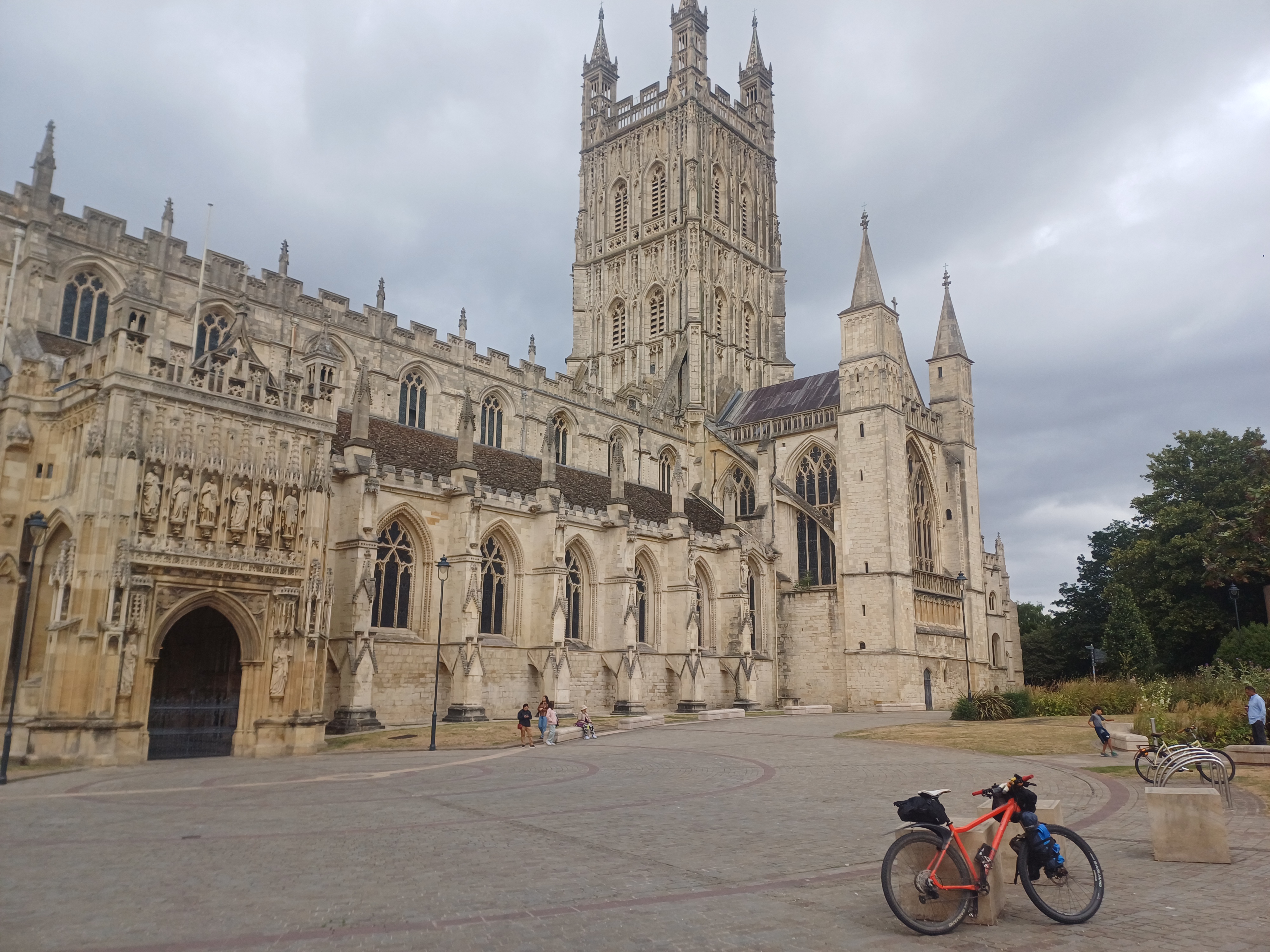
The Cotswolds is not a part of the land I’d much cycled in. Pasting in from Wikipedia, the name means literally “sheep enclosure in rolling hillsides.” It’s a great off-road cycling location that an experienced route-setter like Graham Foot knew how to get the best out of with this year’s Surly 100, a two-day ride that takes one out of town straight into the hills, but on wisely-chosen trails that, while tough, are definitely rideable. I’ve written up what I’ve learned and observed over these two days and hope they’re helpful. A big thank you to Graham, and the wider team who made this event well worth the train trip.
I brought the right bike for ‘aggro gravel’, and this is a great event for people dipping their toes in this world
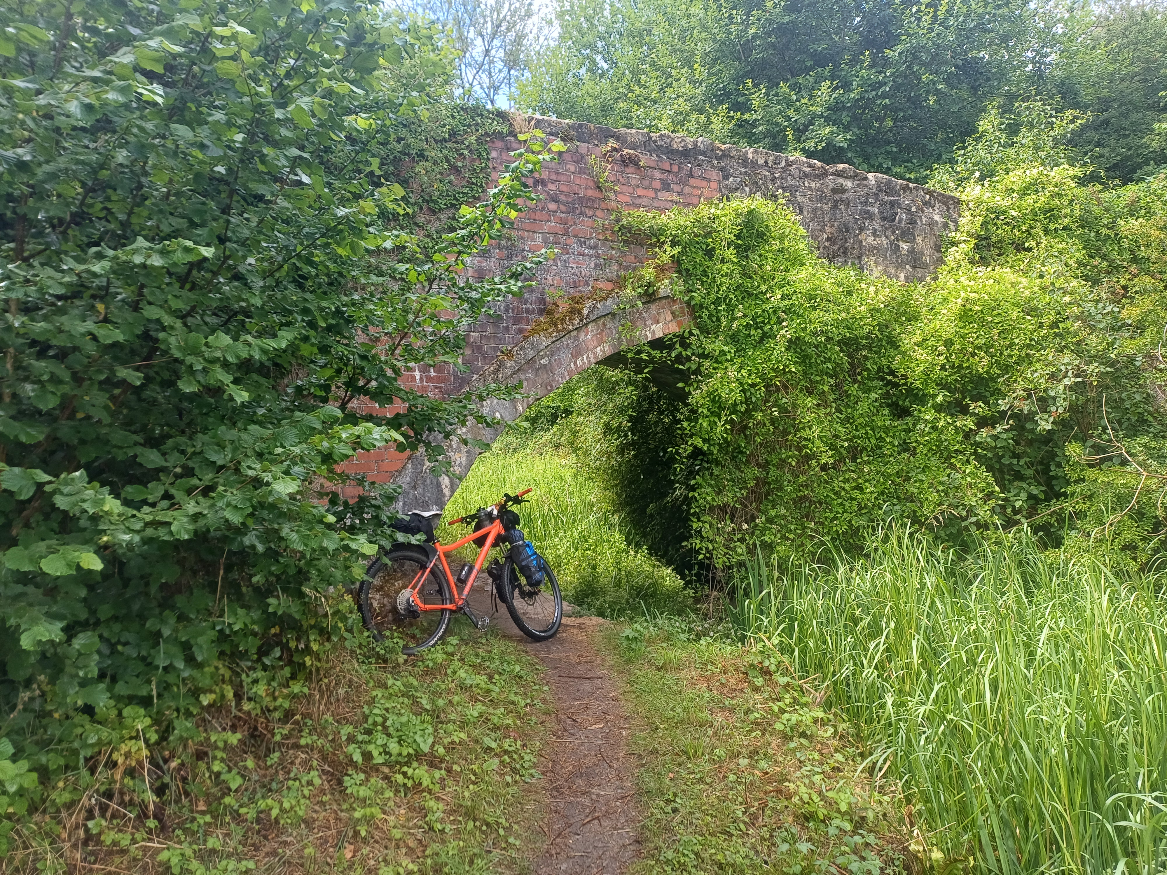
Very differently to the Stone Circle event the week previous (see calumonwheels passim), I would very confidently describe this route, in these conditions, as ‘aggro gravel.’ This is a tongue-in-cheek term that Alpkit came up with to describe the use-case of one of their Sonder mountain bikes, which was obviously designed to raise some eyebrows, but I think it is a useful term. Broadly speaking if you are tough enough and have the technique, this is a route you can do with a ‘gravel bike,’ and some people did, but checking out the bikes at the starting point, the overwhelming consensus from the participants was to have mountain bike tyres and wide, flat bars. There were even a few fat bikes which are always great to see. My Suntour Raidon fork is certainly not the best in the business, but it did help smooth out the lumps and bumps coming from the rocky surfaces both going uphill and down. This route was technical and tricky, and I was very glad to have the hardtail, this time with a gearing upgrade. I’d moved to a 30t chainring (with 170mm cranks), which meant I now had a bottom gear of 30-46. I was hugely pleased that I was able to ride 100% of the route on day 1, and only had to hike-a-bike the once on day 2.
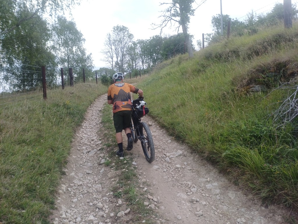
What sets this ride apart from many others is that being an overnighter, unless you’ve made arrangements to drop your camp gear off at the midway point at the start of the ride, you are carrying everything needed for your sleep-out with you. I think this is a tremendous idea that sets people up for practising their ‘bikepacking’ skills for future adventures. If the worst comes to the worst, Graham is on the Whatsapp and can probably come and help you out in his van in the event of a real bike mechanical breakdown, the route being a circular one, and everywhere on it being pretty get-to-able with his van, or even maybe taxis from Gloucester. Unlike events like the Pan Celtic Gravel Rally, the Cotswolds are located quite close to a major port and you’re not in the true back of beyond at any time, at least by my standards. There was even phone signal throughout nearly all the course. So while it is a testing ride which left everyone feeling like they’d put a fair old push in, I think this would be a great event for anyone feeling like getting in to off-road ‘bikepacking’ or just mountain biking more generally. But in my view you should err on the side of gnar and bring a bike with full-width mountain bike tyres at the very least.
I think this route has made me start to want wider tyres. I do like my trusty Bizango, the Halfords coke can special, but 2.25 inches is definitely the widest rubber they can take at the back and the non-boost spacing definitely means for any terrain gnarlier than this, or in harder conditions, they will hit a hard stop. This is more data for me to consider for a future bike change. On the other hand, wider tyres will inevitably make for a slower and more draggy ride on less technical routes, so like with anything, it’s all compromises and you will never have one magic bike that is set up perfectly to be optimal for everything.
Something that I definitely do need to do sooner rather than later is replace my DMR Deathgrips which have now worn right the way down and have me almost gripping bare aluminium, which is no one’s fault but my own.
Turn your head unit’s audio cues on so you don’t miss the turnings like I did
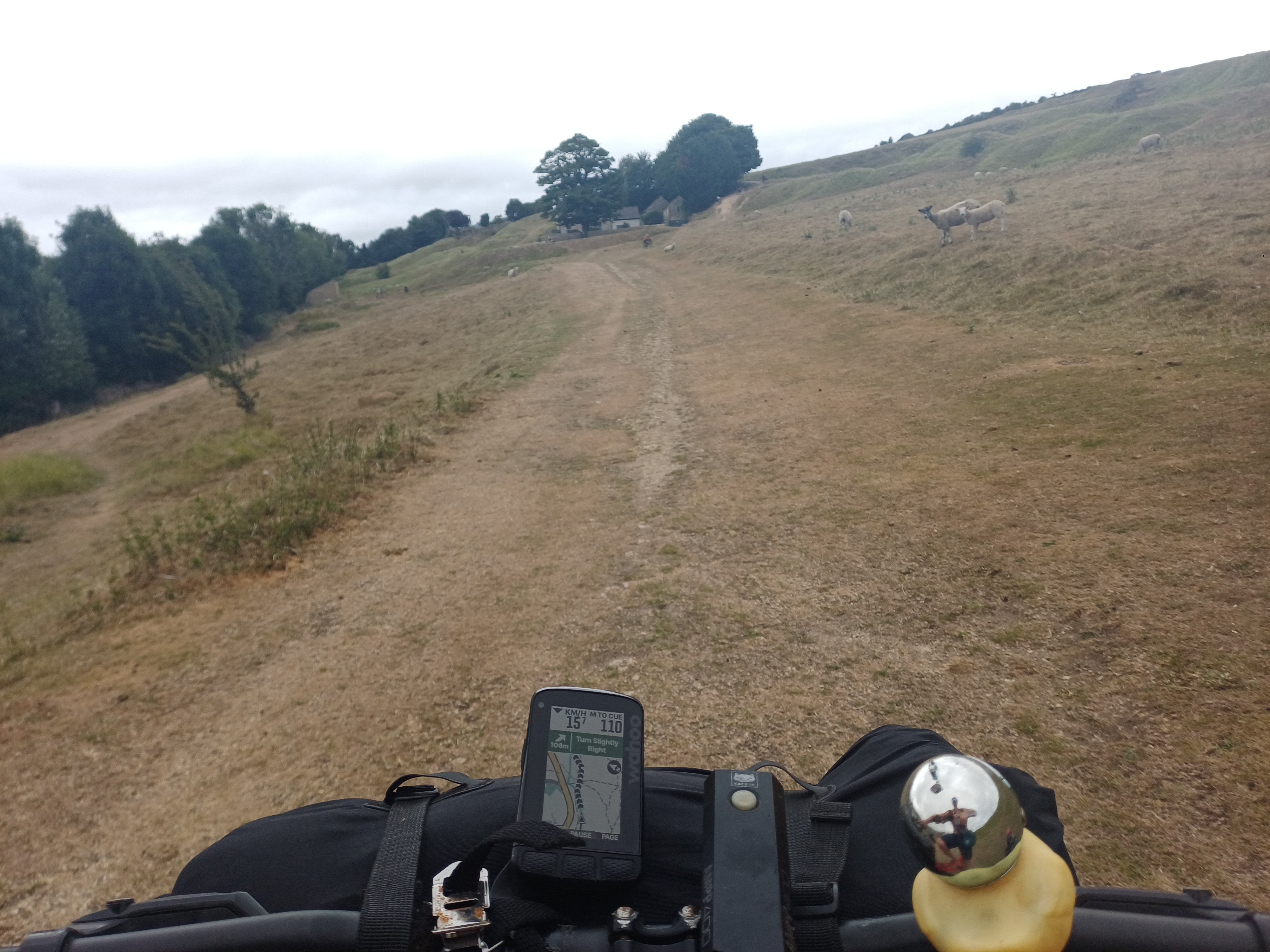
Graham is an experienced hand with choosing the routes, and much of the Surly 100 diverts off of roads on to bridleways at easily-missed junctions. I think I missed turnings quite a few times despite having an Element Roam 2 for navigation, which I put down to switching of the ‘bleep bleep’ alerts for upcoming turns. Normally, it’s rare I miss a turning, but much of the Cotswolds’ signage is obscured by hedges and trees and Graham’s route often has turn-offs midway down roads rather than at corners of fields.
Our organiser had done a tremendous job ensuring that the route was free of blockages including from newly-developed housing estates and road building projects. The supplied .gpx files were easily imported onto my head unit. I would go so far as to say that a head unit with good navigation features is really worth bringing on this ride; you could probably make do with a phone holder, too if you are on a budget. Just try to find one you can fit a USB cable through to charge your device off a battery pack as you ride, as having a lit screen with the navigation app going will drain your device very swiftly.
This route has amazing scenery and great stops, and you should take the time to enjoy them
Everyone has different aims and expectations for cycling events, and for some people they really do want to put their heads down and smash out a fast-as-possible time, even if an event isn’t technically a race. In our rider briefing on Saturday morning, Graham politely but firmly emphasised that this was not an athletics event and that we should enjoy what was on the route. I’m glad that I did, and have a few recommended stops which I’ve listed below:
Day 1 stops and the campsite
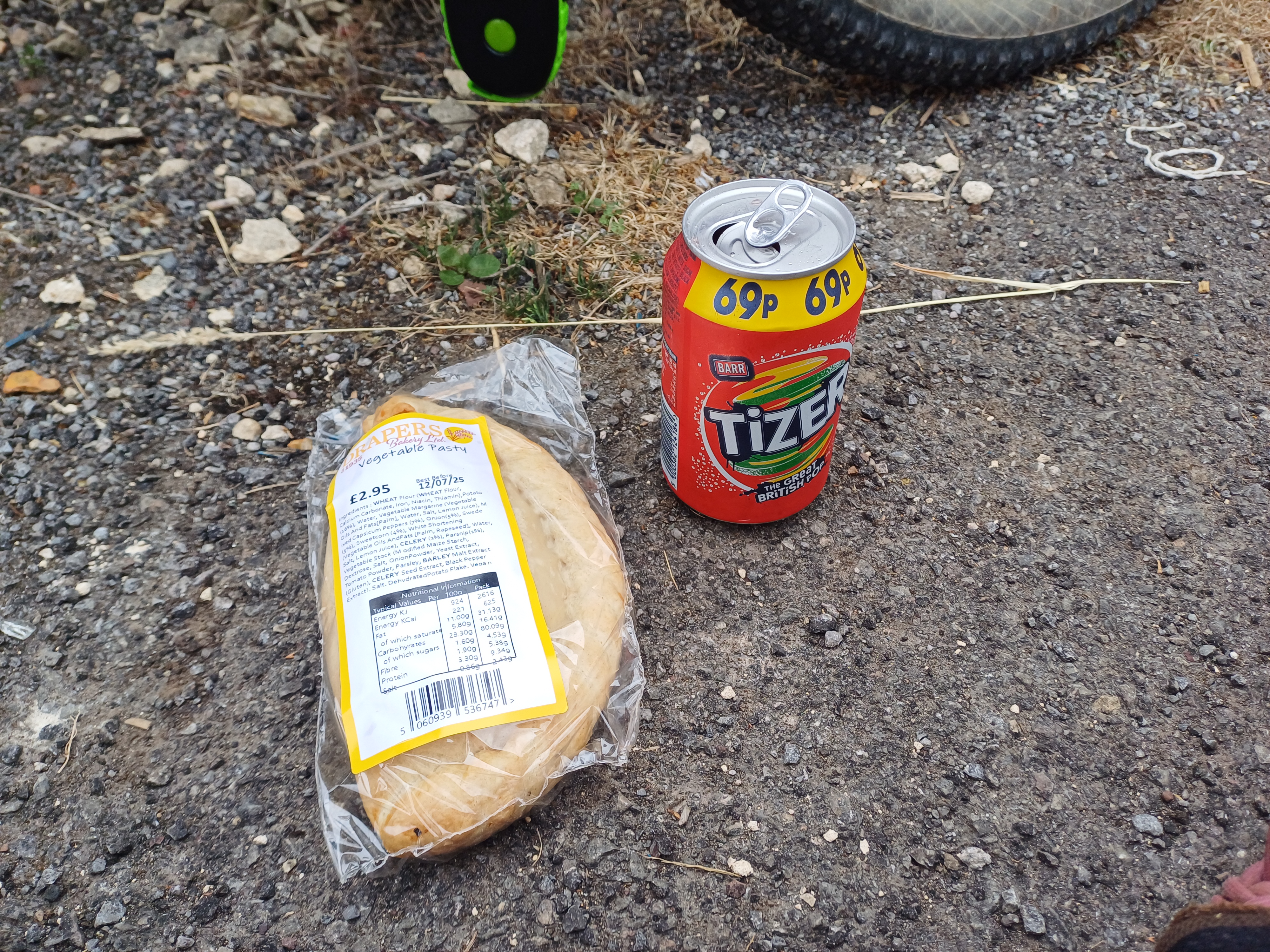
I gave it a bit of a nudge on day 1, as this is by far the hilliest day (82 kilometres with 1300 metres of climbing). Because of this, I had just the one proper pause, which was in Andoversford, at kilometre 58 (out of 82). It has a good shop (‘Dale’s Stores’) and a nice pub (‘The Royal Oak’) to swerve a shower at, with generous overhead coverage and comfy furniture. It was a great spot to discuss what we’d all learned from the route so far, with a few returnees having learned from previous Surly 100 iterations.
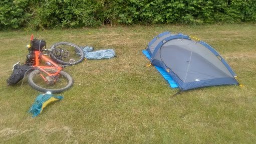
The campsite itself, at the end of day 1, is tremendous. While it doesn’t have a hot shower, there was a cold one, which is good enough for just rinsing yourself after a bit of a scrub with some baby wipes, which left me feeling pretty clean. And more importantly, Graham had booked a special spot aside for us with covered eating tables and hot chili (inc vegan and veggie) and delicious cakes for a cooked supper. This really makes this event worth coming to, as a hot tea sets you up nicely for a quality sleep. The campsite Graham books is flat and I nodded off as soon as I got into my scratcher, having been awake since 0445 to catch my train from London Paddington.
Day 2: Breakfast and stops
Graham and his team had put on a top-notch hot spread for us in the morning. Catering for events like this can be hugely tricky, as you want the grub to be hot and fresh but you don’t want queues forming either. Graham’s team were serving hot breakfast rolls washed down with tea, which were what the doctor ordered. Day 2 is a much gentler ride, still with some tricky gnar, but with just 570 metres of ascent over about 80 kilometres. This meant there is added time to stop and explore, and I’m glad I seized my chances.
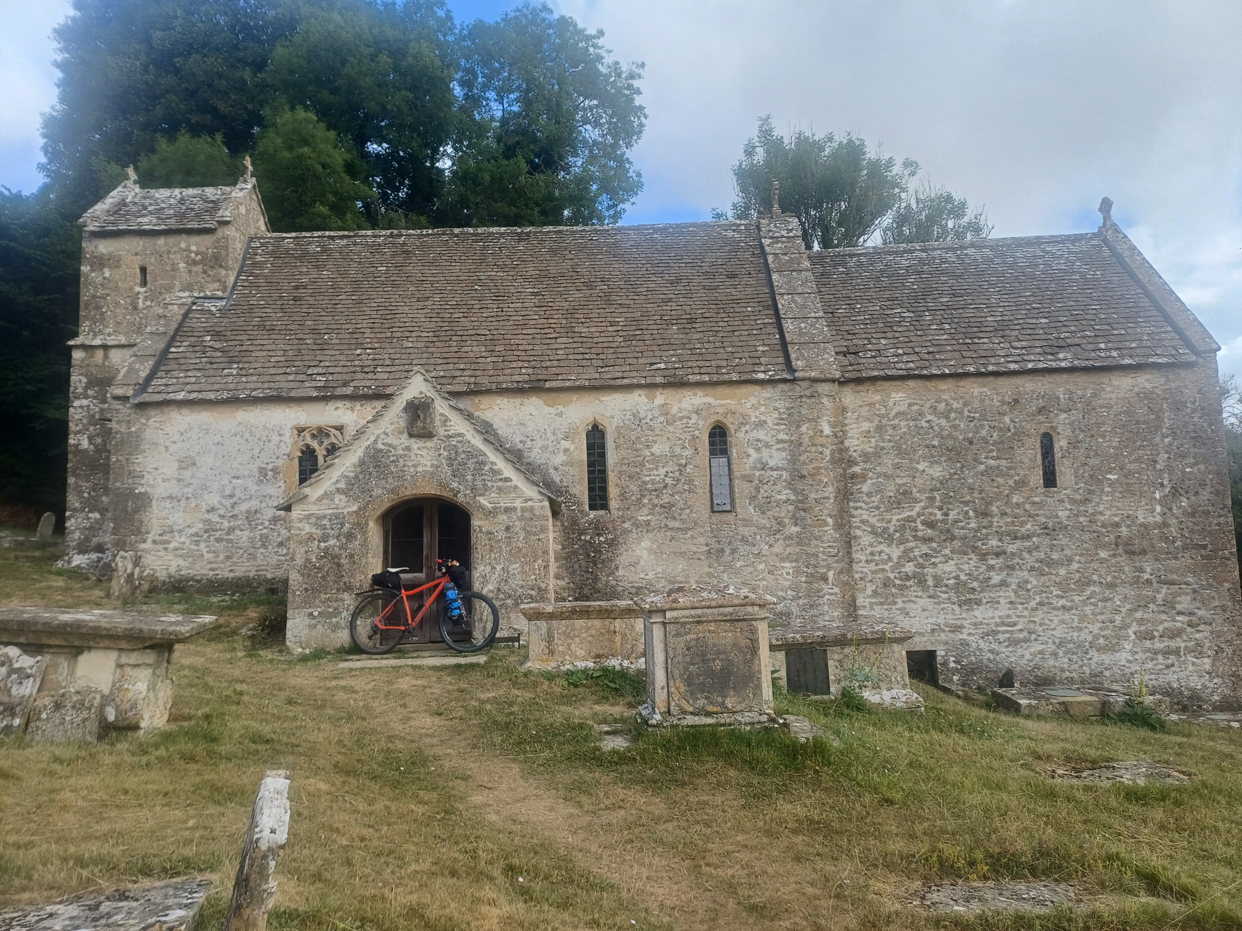
The first stop I think you should make is St Michael’s Church in Duntisbourne Rouse. This can be easily missed, as the only clue is a sign that reads ‘Saxon Church,’ but it is deeply connected to English history, as the village is listed as ‘Duntesborne’ in the 1086 Domesday Book following the Norman Conquest. ‘Rouse’ is seemingly from a ‘le Rous’ family, who were recipients of the lands following William the Conqueror’s (or The Bastard, depending on who you ask) carve-up of England’s land and associated wealth to reward his lieutenants and knights who accompanied his invasion in 1066. There is a good postcard on the notice board showing sheep being grazed among the gravestones to trim the grass down.
By kilometre 30 out of 80, I was craving a coffee, so I asked someone on my way towards town if they could recommend a café. Their recommendation was Lynwood & Co opposite the Church of St John the Baptist, which was delicious and a good place to appreciate this splendid building. Worship has occurred here since the 11th century CE, but following huge wool industry revenues in the 16th century, massive renovations were done, making it a so-called ‘Wool Church.’ Cirencester was disputed ground during the conflicts between Royalists and Parliamentarians in the 17th century, and it’s understood it was used as a prison during the town’s changing-of-hands during the civil wars. I regret not going inside, but it was a Sunday morning and worship was on.
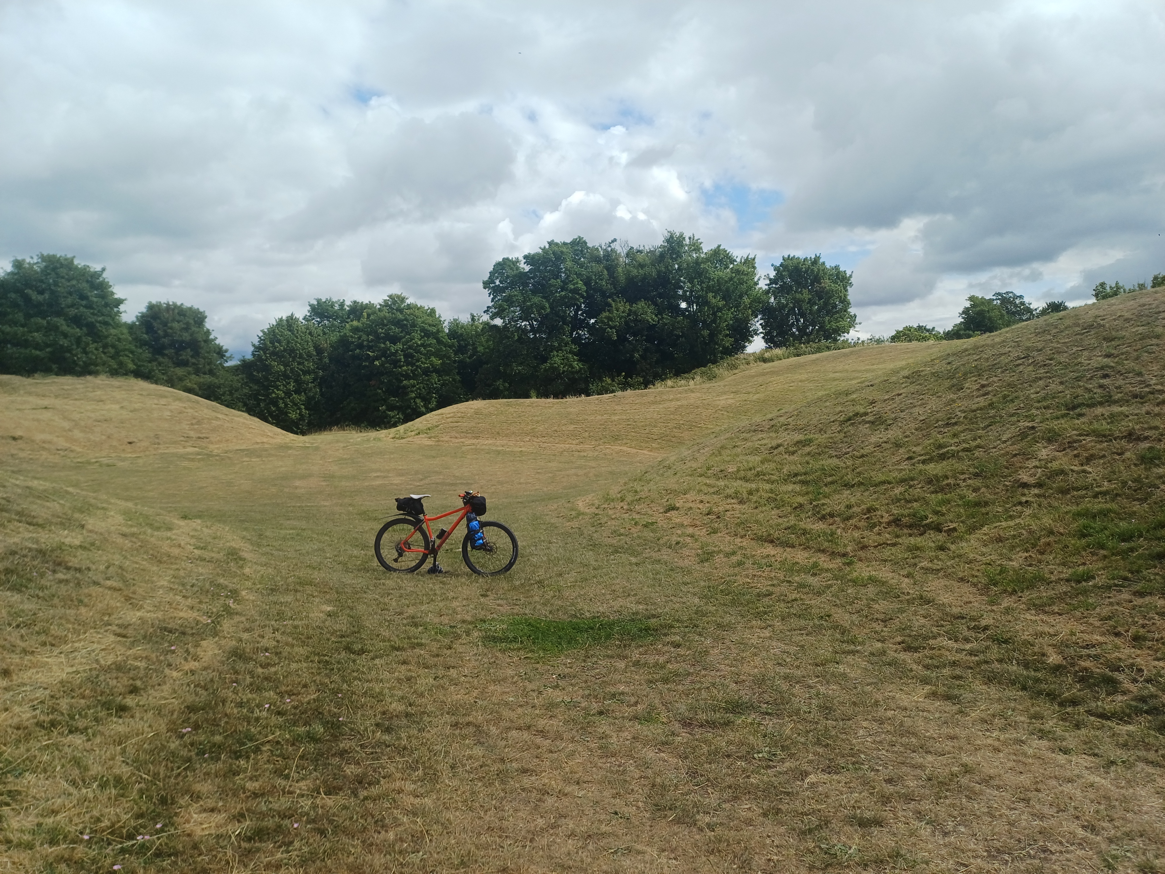
Where I did stop in at, on the way out of town, was the Cirencester amphitheatre. This is a stunningly well-preserved amphitheatre from the 3rd century CE, and is well worth wheeling your bike in (English Heritage prohibit cycling). If you’re really interested in geography and want to make time, you’ll also be very close to the so-called source of the river Thames in Coates, on the route, though most people would agree the Thames is not navigable until one gets to Devizes, and even then, expect to do a lot of stopping and ‘portaging’ your canoe.
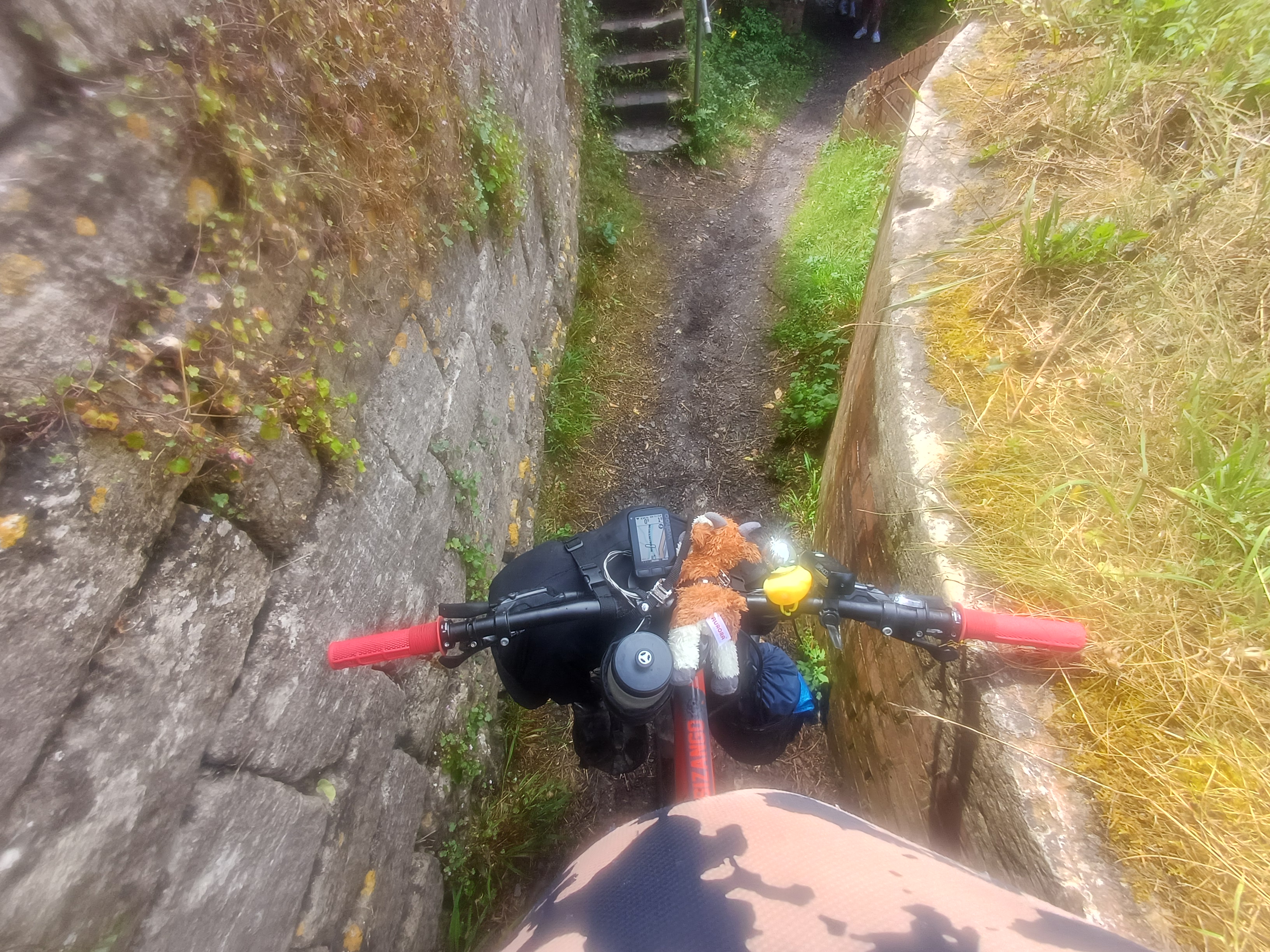
I’ve merged these last two stops in to one. In this edition of the Surly 100, we joined the (long-disused) Thames and Severn Canal towpath at Daneway, which leads to Stroud. I had some nerves as in my experience, towpaths tend to be a bit narrow and hair-raising, and you’ll be sharing them with people who may prefer you weren’t there. Thankfully, it wasn’t too busy on the towpaths we rode through, but they were still the most difficult and hazardous-seeming part of the ride to me. My wide, grippy 2.25 inch 29er tyres made me feel much more confident than had I been on skinnier ones like the Schwalbe ‘Allround’ 35mm gravel tyres on the Merlin. Things mellow out a bit once you’re past the Stroud Brewery and Taproom, which many riders had stopped in at, and is to be much recommended.
I probably need a new phone because these photos are a bit poor
Sadly, I think this trip has spelled out to me that I don’t think my photos are really cutting it. Many of them are coming out with funny lighting and fuzzy shapes, despite my always taking a second to give the lenses a wipe with my jersey. I’ve spoken to some people in the know and apparently Pixel phones are the best Android ones for photography. I’ll try to move this Samsung one on and upgrade in due time.
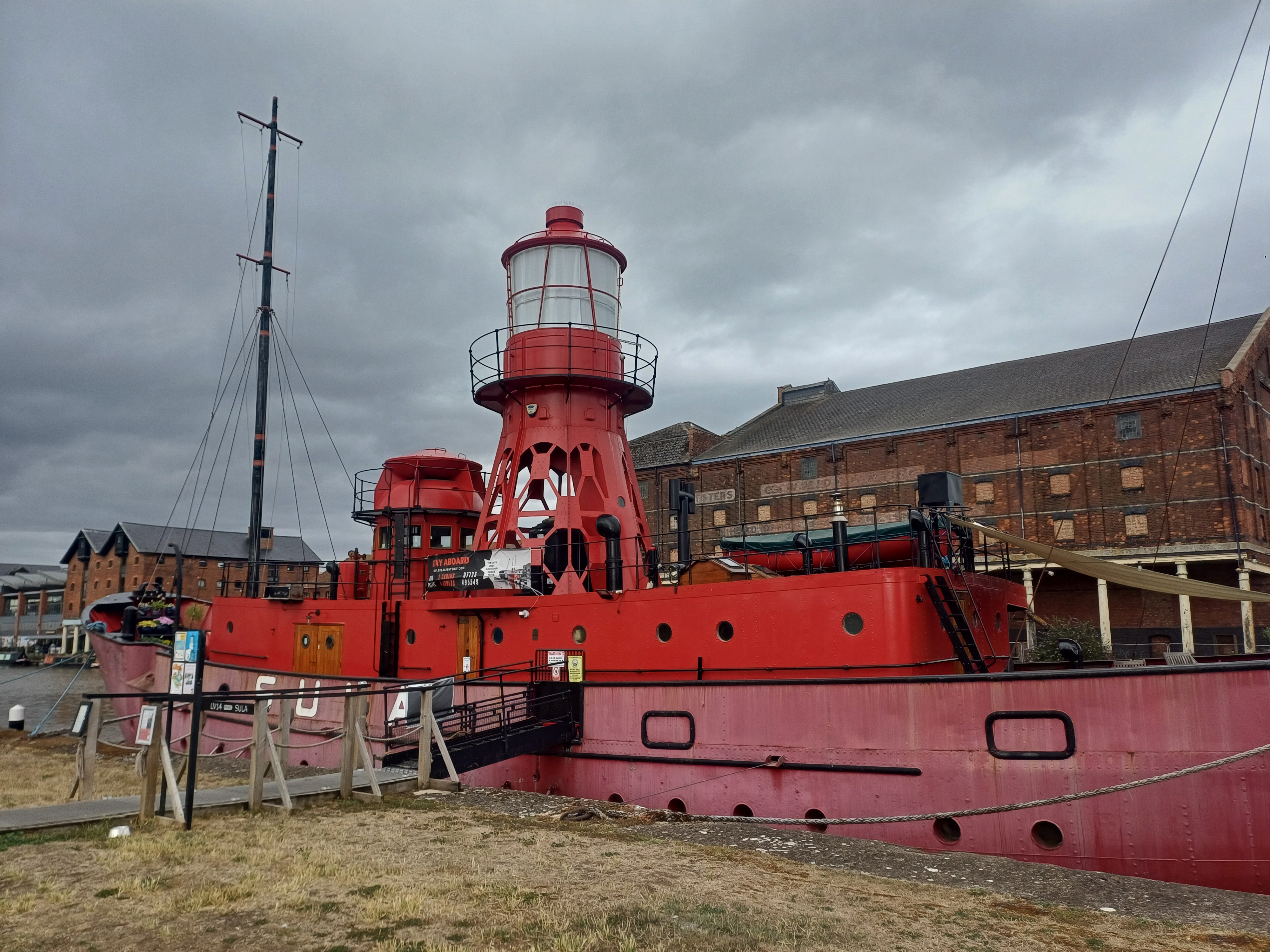
The final 15 kilometres or so of this ride are alongside the much wider Gloucester and Sharpness canal. This is a well-maintained and active waterway, with its own authority doing maintenance work to keep its towpaths cleared and trimmed. This canal goes right the way to Gloucester Docks. You wouldn’t realise it when you’re there, but this is the most inland port in all of Britain, and it has some delightful little vessels moored up there, including a lightship which you can rent as accommodation.
Wrapping up
I will aim to be back next year to do this great event again, and hopefully you’ve got the message that I strongly recommend it to you. As I mentioned, I wouldn’t mind having wider tyres to do this with. There were a few people using fat bikes on this ride, which I can understand, especially if you already own them and are ploughing them around the land for much of the rest of the year. I was very impressed with their capability at crawling up steep, rocky inclines with low pressures, as their wide contact patches enable the rider to keep traction and stay cranking. Graham organises fatbike meet-ups in the region, which I think are well worth looking into, especially if you’re aiming to keep trucking off-road throughout the year. Though I think you will struggle to fit a fatbike on to the GWR services from Paddington to Gloucester.
A big thank you once more to Graham, and the rest of the team who made this all happen. Visit his website to keep track of future events at https://grahamfootbicyclelover.com/ and follow his Youtube channel https://www.youtube.com/@GrahamFootBicycleLover for more learnings.
STOP PRESS: Graham has published a post in the whatsapp group about his plans for the 2026 Surly 100 (edited for brevity):
SURLY100 2026 date is 4/5th July [2026]. There will be route changes, although I plan to keep as much of the favourite trails as I can, plus more distance options for next year.
The 2026 SURLY100 will now be run from one location, offering the option to leave your gear if you wishFor those not wanting to camp at all you have that option also.
Parking will be on site for those driving, although we encourage riders to ride/train to the event if they can. There will be 3 distances, over 2 days of riding. (To Be Confirmed). Keep an eye on here, also the GFBLevents page and of course all the details will be on the official website
https://grahamfootbicyclelover.com/surly100
Can you please share the route?
Graham works very hard to ensure his routes are rideable and unobstructed on the days of his events. For instance, on day 1, our .gpx file had a very detailed get-around for the area that was being redeveloped for housing and roads. Out of respect for Graham’s hard work, I will not be sharing the routes in this article and would just recommend signing up for the event next year; it would be cheap if it were twice the price.